
We made 3 walks in Mallorca of which 2 were done in the Nature Park of Levant, the North-east region of the island between the towns Betlem and Artà. Making use of internet resources, we picked 2 hikes: one in the “expert” category called Puig de Sa Tudosa via Sa Valma and another in the “difficult” category called Sa Talaia Freda. We made use of the PDF maps provided by the websites linked but in addition, made sure that our Android phones had GPS switched on and the map of Mallorca downloaded on the app, Maps.me. We were ready for this!
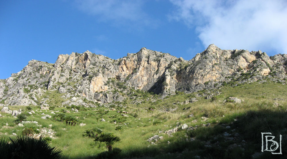
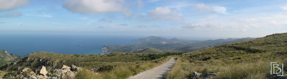
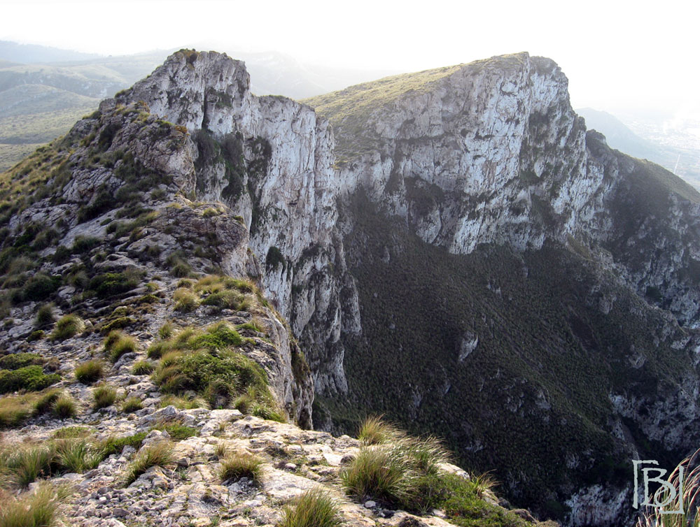
On our first day, we walked Puig de Sa Tudosa which started from a town called Betlem. The start was easy going and the trail was clear; a dirt path that eventually led to a dry river bed. The PDF itinerary we had printed out made a short comment about this trail having 2 sections of the walk where the path was not visible. For these sections, we had to follow markers which were piles of stones. Hubby and I didn’t think this would be too hard as we’ve made other walks and we’ve never encountered much difficulties following markers like this. So following the piles of stones, we were led to the foot of a mountain (like the ones in the picture below) and we knew we had to hike over the mountain but we couldn’t find a path nor see any other markers. It was like, the trail had vanished. We’re not rock climbers so we weren’t enthusiastic about climbing over the mountain.
After 20 minutes of scouting around looking for a way up, we turned to our GPS navigation and by comparing this to the map on our PDF print-out, we figured out that we were on the wrong part of the mountain; we needed to be further inland. When we finally found the trail again and were a little higher up the mountain, we turned back to have an overview of the lowlands. This was when we realized that there were 2 trails marked by piles of stones: one which was the wrong trail we followed and another which was the right trail.
This was the beginning of a very adventurous walk as the markers during the descent to Es Caló where the path was also not visible, misled us with random piles of stones sprouted everywhere. We didn’t know which ones to follow even with a GPS navigator. The other tricky bit was that the markers were not so clear. Sometimes we found them behind a bush or a huge rock so unless we had Superman’s X ray vision, we couldn’t see them, and sometimes they were so short (a pile of 2 or 3 stones) that we weren’t sure whether they were put there deliberately to mark the trail or whether they were a part of the rocky landscape. Because of such difficulties, we got lost and missed Prisoners’ Path and the Military Camp which we really wanted to see. Despite this, the parts of the walk which we could follow were beautiful!
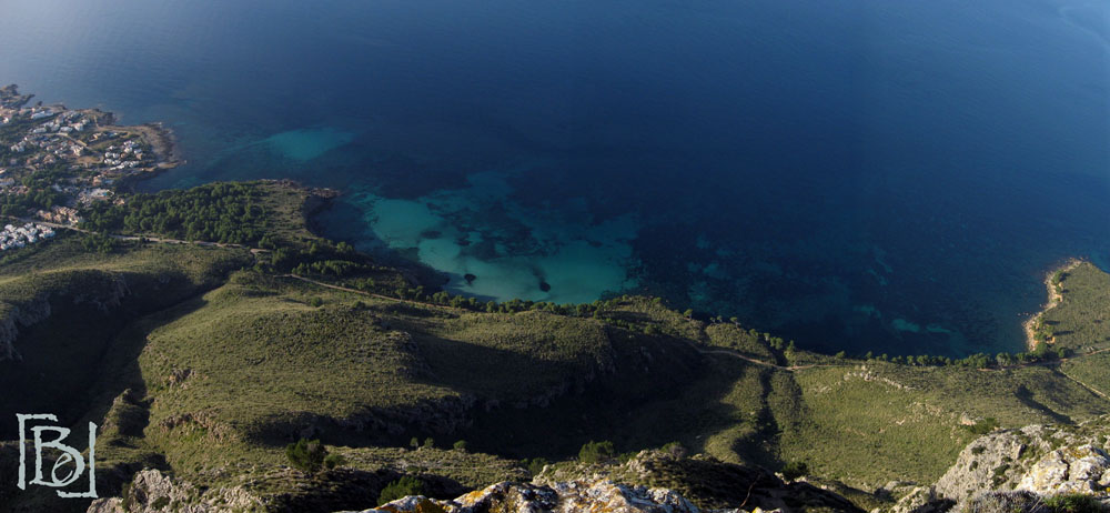
Our second hike in the Levant Nature Park was Sa Talaia Freda. This hike was amazing! The circular route essentially takes you up the mountain Sa Talaia Freda, down the mountain and back along a coastal trail that has a spectacular view. The paths were very well marked and easy to follow – a clear contrast to our previous hike on Puig de Sa Tudora. The only thing that was difficult about this route was the descent down Sa Talaia Freda. To be honest, if I were to repeat this hike I would walk the route in reverse because climbing up the steep face of a mountain is easier than trying to get down. Besides this, this hike is highly recommended!
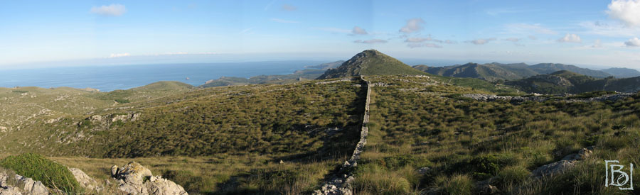
We completed the hike in half a day; we took an hour longer than what was estimated by the organizers. From Sa Talaia Freda, we climbed down the steep face and up another mountain called Puig de Sa Creu. The walk to the second peak was along the ridge of a cliff which can be a little bit unnerving especially for someone with a fear of heights. Nonetheless, the walk all the way back to the starting point was relatively easy with a well marked path and a few mountain goats to keep you company in the empty mountains. 🙂
Having completed two routes in this region of Mallorca, the Levant Nature Park is a beautiful area for hiking. Perhaps part of its charm comes from the tranquility and solitude of the region.

One thought on “Hiking in the Levant Nature Park, Mallorca”